-


-
-
Softwares
Logistics

Tookan
Delivery management software for optimizing fleet operations

Evermile
Last-mile delivery orchestration platform with real-time tracking

Mappr
Route optimization and territory mapping for delivery networks
Commerce

Yelo
On-demand delivery platform for restaurants and retail businesses

Jugnoo
Hyperlocal delivery and ride-hailing solution for urban markets
Pickup and Delivery Apps
Hassle free ordering process with Tookan Customer apps.
Growth

Outplay
Sales engagement platform for high-performing teams

Appvirality
Referral Marketing Software Designed for Accelerated Growth

Rivia.ai
One platform to showcase, onboard, listen, and grow

Super Hippo
Customer engagement platform with omnichannel messaging

Growthscore
Collect Actionable Feedback and Boost Customer Satisfaction with NPS

NOTP
customer engagement solution that lets users log in or sign up via WhatsApp
-
-
Brands
- Consulting
-
Ordering
Food Grocery Home Services -
Delivery & Dispatch
Pick Up & Delivery Courier Delivery 3PL Delivery Dispatch -
Consultation
Telemedicine Fitness Legal Consultation -
Mobility
Taxi Software App Like Uber Car Rental -
Customer Engagement
Conversational support WhatsApp Marketing Customer Acquisition -
Sales Engagement
Inbound Sales Pipeline Management Sales Performance Analytics
Explore All Industries
-
- Brandcamp
-
Learn


Blog Mappr
Mappr
How to Leverage Geocoding API for Your Online Marketplace in 2021?
Imagine your customers getting lost due to wrong addresses; the same goes for delivery agents like lost entities without geocodes. It is a set of longitude and latitude that defines a location on the map. The only difference between physical and digital maps is that you need to code these location specifics for representation in the delivery agent’s app.
If you are wondering why you should invest in geocoding api, take the example of using a normal zip code instead. Address identification through zipcodes can be difficult because one zip code can cover about 10 to 20 locations. So, accuracy can be a massive issue with the conventional form of mapping and navigation.
Here, geocoding API can be the best option for your delivery business. Let’s first discuss what geocoding is.
What is Geocoding?
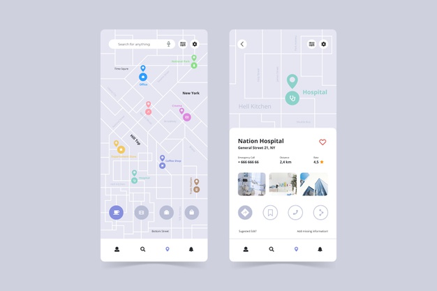
Geocoding API is converting the physical addresses into spatial data and coordinates that can be used to locate them on maps. It allows businesses to use these spatial coordinates to map the location of their delivery agents and find customers’ addresses.
The process of geocoding is used in a wide range of applications and interfaces, including web portals, mapping sites, and apps like Google maps or Apple maps. There are many different types of geocoding approaches used by organizations like interpolation-based, point-based geocoding, and reverse geocoding.
For interpolation-based geocoding, the streets have an address range that offers an approximation of the start and end values. At the same time, point-based geocoding data sets include longitude, latitude, intersections, and points of interest. It offers far more accurate locations than the interpolation approach.
Reverse geocoding converts a point location into a corresponding street address. It is instrumental for delivery businesses to allow their users to track every movement of the order. For example, with a reverse geocoding API, you can allow users to track an approximate position of the delivery truck with a GPS device.
If you are an online delivery marketplace or delivery business, reverse geocoding API is the best option for mapping locations. So, let’s discuss how you can integrate such an API into your apps?
Reverse Geocoding API Integration

There are many mapping and navigational API services available in the market that offer integration with your applications. For example, Mappr is one such mapping solution provider that offers customized maps and pre-built reverse geocoding API. Mappr is a great option compared to other services like Google maps due to the level of customizations and pricing.
Google maps is a popular mapping solution that offers services in the price range of $0 to $5000. It provides a pay-per-use model that is free up to a credit amount of $200, and further, your credit card is charged based on the services you use. Apart from these, you may have to pay an additional $1500 for add-ons.
At the same time, Mappr offers flexible and affordable pricing plans for your business needs and is an excellent alternative to Google maps. The first plan provides free usage of geocoding, places API, directions, and Map Load services for up to 1,00,000 transactions for free.
The next plan is priced at $209, which offers all the features from the free plan plus an advanced one like custom map themes, chat support, mobile SDKs, and many more. The final plan offers premium features at $375 per month and supports up to 2 million transactions.
Apart from the pricing, Mappr also offers easy integration of reverse geocoding APIs for your delivery business and is one of the finest alternatives to Google maps. All you need is to perform a GET request on the following endpoints,
<a href="https://maps.flightmap.io/api/search_reverse?fm_token=&lat=30.6944792&lng=76.8796062&zoom=18″ target=”_blank” rel=”noreferrer noopener”>https://maps.flightmap.io/api/search_reverse?fm_token=<your API key here>&lat=30.6944792&lng=76.8796062&zoom=18
Reverse geocoding APIs offer a feature to search any desired location on the map through the above request. You will have to type latitude and longitudes for the search of any location. For search requests, you need to enter details like,
- Mappr token from the dashboard
- Enter a latitude and then longitude for the location
- Enter the number of zoom levels for your search.
Here are the zoom level numbers for input,
| zoom level 3 | refers to Country |
| zoom level 5 | refers to State |
| zoom level 6 | refers to Region |
| zoom level 10 | refers to City |
| zoom level 12 | refers to Town/Village |
| zoom level 14 | refers to Suburb |
| zoom level 18 | refers to Building |
| zoom level 3 | refers to Country |
The response to your GET request will be in a JSON format,
{
“message”: “Successful”,
“status”: 200,
“data”: {
“address”: “Panchkula, Haryana”,
“formatted_address”: “Unnamed Road, Panchkula, Haryana 134109, India”
}
}
Conclusion
A reliable mapping solution is essential to your business and Mappr can be the perfect service provider. Significantly reverse geocoding API service from Mappr can enhance your apps’ entire user experience through effective tracking of orders. So, if you are looking for a tailormade mapping solution for your business, get in touch with us.
Read more – Mappr Location Data Testing With Foreign Government
Subscribe to stay ahead with the latest updates and entrepreneurial insights!
Share this article:


Subscribe to our newsletter
Get access to the latest industry & product insights.
You may be interested in these articles
-
flightmap20th May 2021
One-Stop Solution for all your Business Mapping Needs- MapprThere are a plethora of apps using maps, route optimization, and location.. [..]Read story
-
flightmap29th July 2020
How Flightmap’s Endless Customizations Can Make Your App One-of-a-KindThese days, it is very common to find apps that make use of maps, location.. [..]Read story
-
flightmap12th June 2020
The Best Ways to Enhance Route Optimization in Your BusinessThe modern world, as we know it, moves at lightning speed, and with each day,.. [..]Read story
-
flightmap25th April 2020
How to keep your business unaffected with the unexpected map crashing events?Mapping platform has an incredible influence on many of the business.. [..]Read story